If sailing north Corsica had been amazing, to sail west Corsica was even better. Given that I’m writing this several months later from our winter berth, I can confidently say it was my favourite area of this year’s summer cruise.
It had clear, electric blue water, abundant sea life, walks and dramatic scenery. In addition, the feeling of being somewhere a little bit off the beaten track gave the area the edge for me.
But if it’s so wonderful, why isn’t everyone else there? Well, it’s the mistrals that blow old boots out of the Golfe du Lion, and cause waves to pile up into the Corsican coast. You really do need to keep an eye on the weather and be ready to run. Our usual practice of hanging around an anchorage for days (and sometimes weeks) in the places we love was not possible here with weather forecasts changing daily. We would look at the forecasts on one day and see settled weather for the next 5. However, by the next day it was all change with strong westerlies to deal with. Luckily, for our 10 days there we only had one strong blow to contend with.
But despite the weather risks there are plenty of good reasons to sail west Corsica.
Around the Corner of West Corsica to the Scandola National Park
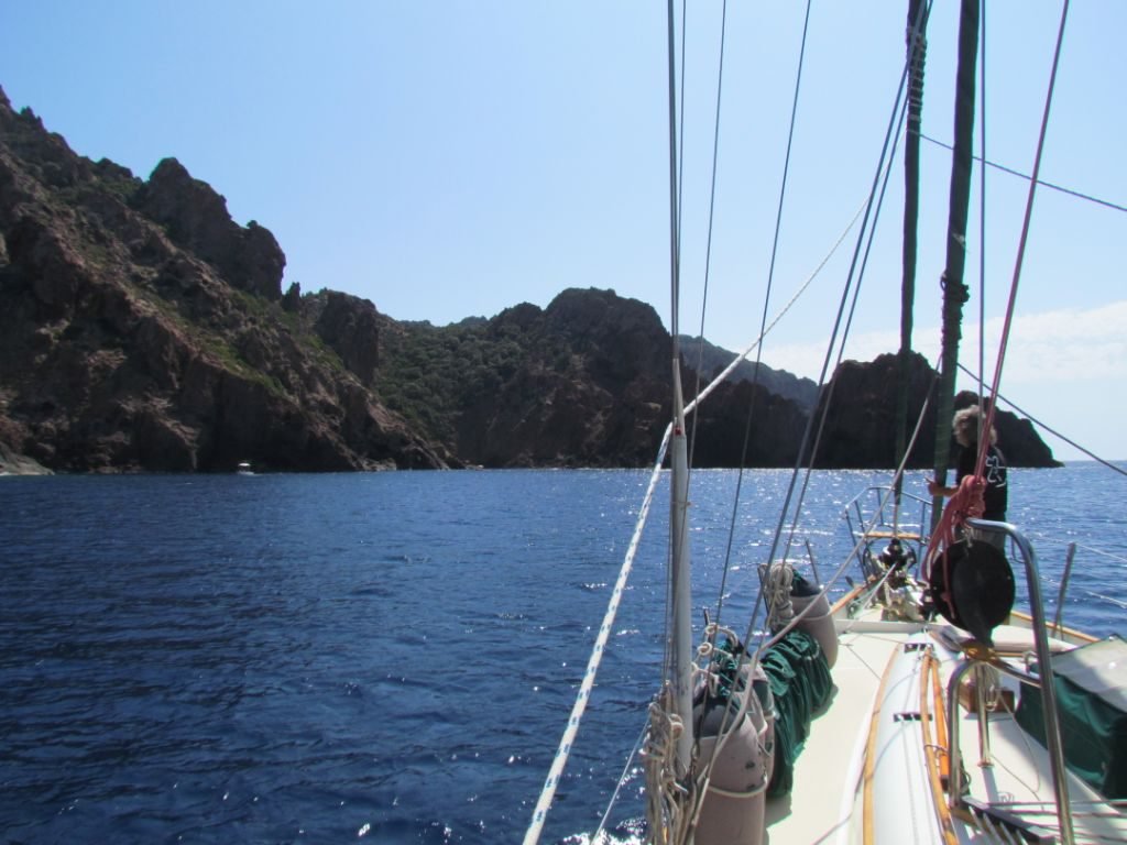
5th September – with southwest winds now eased and backed to light northerlies, it was the ideal time to head off around the north west corner. The sun was shining, creating diamond sparkles on the water surface. As the morning turned to afternoon the wind picked up enough for a slow downwind sail. Steep, dramatic cliffs lined the coast with anchorages possible only in settled conditions.
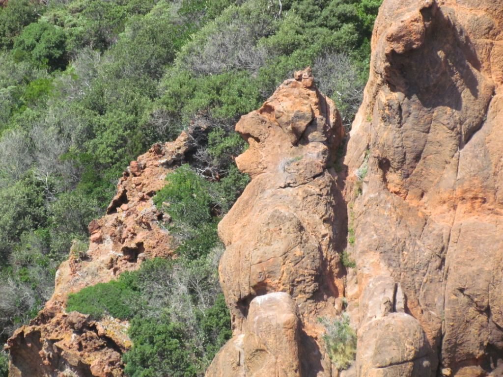
The Scandola national park is an area of rust-red rocks that create a weird and wonderful formation of pinnacles, arches, rugged coves, and steep cliffs. As we approached the wind dropped and the engine went back on. We didn’t mind as we wanted to have a close up look in the nooks and crannies by dinghy. However, this was only possible if we could find a safe spot to temporarily leave Emerald as anchoring in the park is only allowed during daytime. There were a couple of possible anchor spots marked on the charts. But when we arrived at the locations, both the swell and the depth put us off trusting our home to be left safely there. Instead, we made a lap in Emerald and made a video.
Girolata
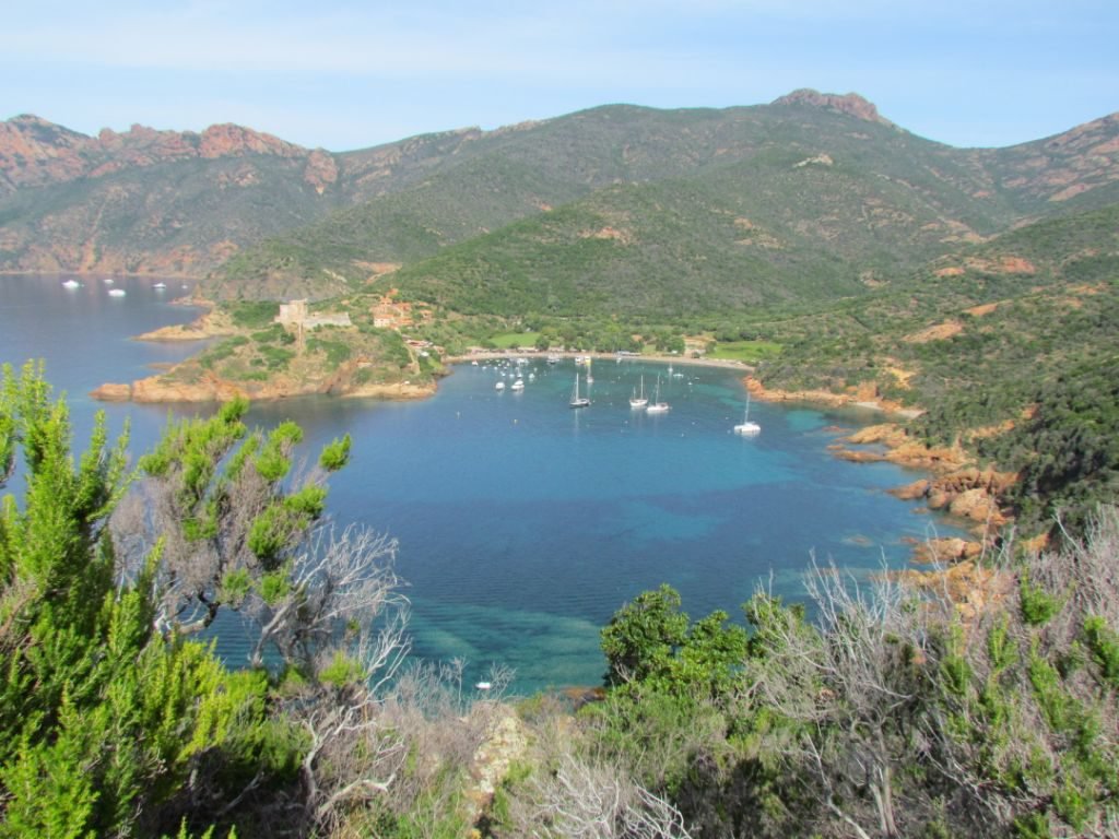
Around the southern end of the park, there is a large bay called the Golfe di Girolata. In the middle of this bay is the tiny village of Girolata. Here there are mooring buoys as well as several nearby anchorages, including some coves just outside the park boundary on the northern edge of the bay. We’d seen hardly any other yachts all day, but there was a huge catamaran and an almost as huge powerboat in a small space where the seabed sloped steeply.
We squeezed our way in but having set out our preferred length of chain, we felt a bit too close to the rocks along the side. So out came the binoculars for a spy on the other spots. On the far side of Girolata was Cala Taura – we could see a handful of yachts there but Google maps showed a large area of sand and decent depths. We were off.
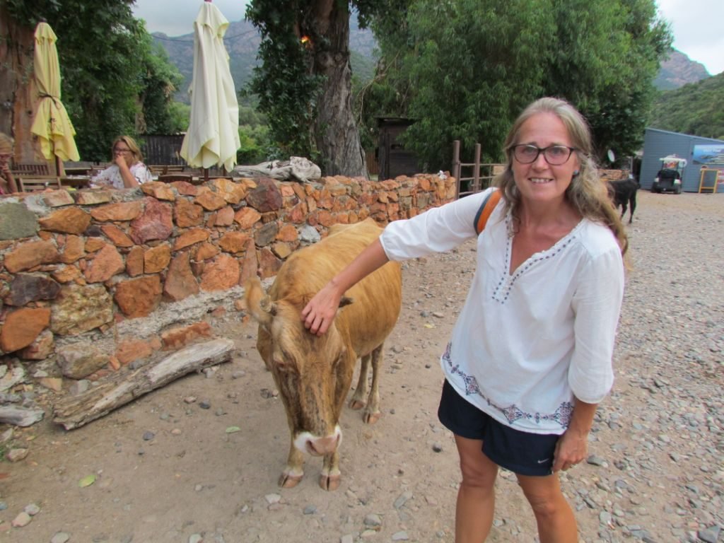
It turned out to be a good decision. There was indeed a large area of sand and clear water to see where it was. We had plenty of space for us to swing. Plus, as a bonus, there were cows on the beach and a walking trail.


Cala Taura
The next day was calm and sunny so off I went for a walk to Girolata. There are two marked trails so you can make a loop out of the hike. Girolata is the hub of the gulf and the only way to reach the village is by boat or foot. A steady stream of trip boats calls in to let their passengers stroll around or stay for lunch. Lining the beach are a couple of bars and some wooden shacks selling souvenirs and basic groceries (including fresh bread). Higher up and out along the peninsula are the restaurants with their views across the moorings. And topping it off is a ruined castle, but alas it was closed to visitors.
The cows also liked to visit this beach. Also, judging by the ‘deposits’ I saw along the trails, they hike back and forth between the beaches. The cows are very friendly and up for a scratch.

Under the water, the scenery was stunning too with varied shoals of fish flitting about in shafts of sunlight. Snorkelling amongst the rocks along the shore, I floated on the surface and watched a ray bimbling about for several minutes. Of course, that was the day I forgot to take my camera with me!
Later that day we took the dinghy around to enjoy some local wines in one of the beachside bars. Rumbles of thunder curtailed our desire for more wine. We hurried back as fast as our 4hp outboard would allow before the storm reached us.


Hairy Weather
The thunder rumbled around the hills around us but never came over the top. But having escaped one storm, the next day there was worse to come. A mistral had formed, blowing out of the Golfe du Leon, 300nm to the west, creating westerly winds up to 40kts way out to sea. Closer inshore we were expecting around 20kts.
By morning the anchored yachts had whittled down to 4 brave/foolish souls. It was somewhat reassuring to have others making the same decision as us. We’d prepared by putting out more chain. We were on a lee shore with the beach behind us but far enough out to let out more chain if things got really hairy. But by mid-morning, we were starting to disbelieve the forecast as only a gentle 10kts caressed us from the west.
I even considered a quick walk to the village for more bread but as we were preparing to go, more wind arrived. And kept on arriving, reaching up to 30kts during the afternoon. The anchor remained where it was but it was an uncomfortable few hours as the swell rolled in. It was frustrating, watching all the land-based visitors enjoying the beach and hikes.
Then as the sun set, so did the wind, leaving behind the sloppy remains of the swell. As we went to bed, the wind turned offshore. It turned us around so that Emerald’s stern was into the swell and hence our sleeping cabin. However, we did get some sleep, with just the occasional big roller jolting us from our dreams.

Ficajola
By the next morning, calm was restored so we continued on south for a short journey towards Porto. I’d read about the tiny anchorage of Ficajola but it is so beautiful, it is often crowded. As it was on our way, we decided to have a look. Our luck was in – only one boat was there and we found a spot in 10m in the sand just outside the swimming buoys. It’s an open anchorage and there was a gentle, residual swell but nothing to turn us green. The wind was all over the place and Emerald gently spun around several times during the day.


Climbing up to Piana
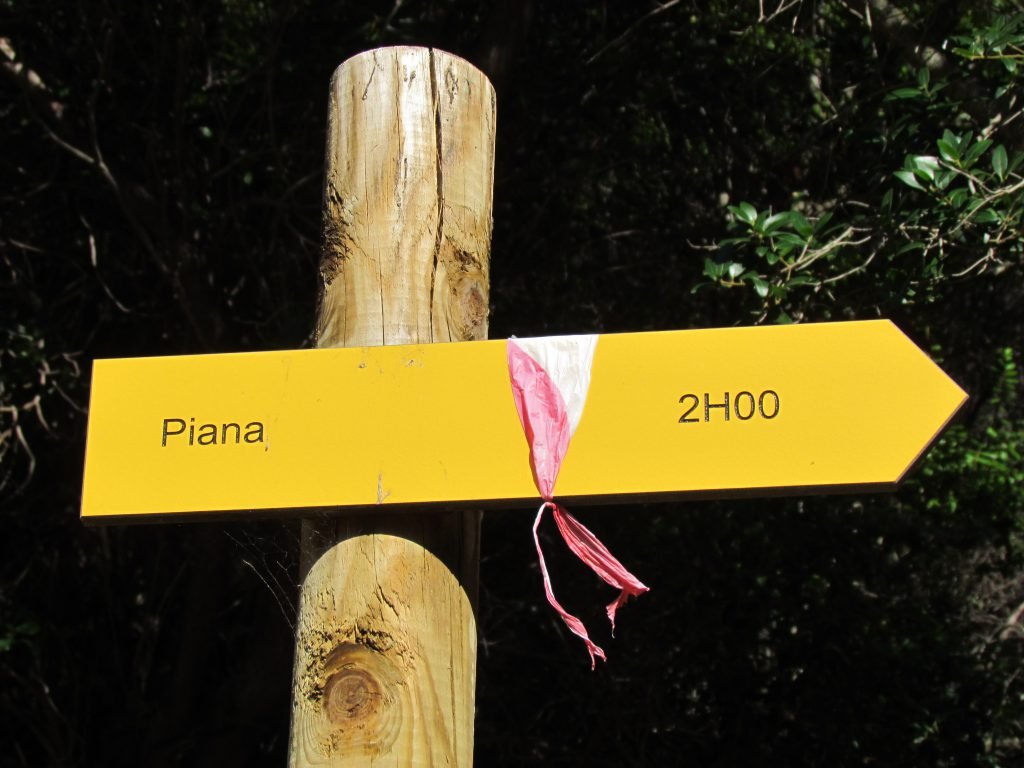
One reason to anchor here is the walk up to Piana – a climb of 600m over 2km. It didn’t take me 2 hours!
The first section is in trees with their welcome shade. However, once higher the hike became rather sweaty in the still-hot September sun. Still, it was worth it and the views provided plenty of excuses for a breather.
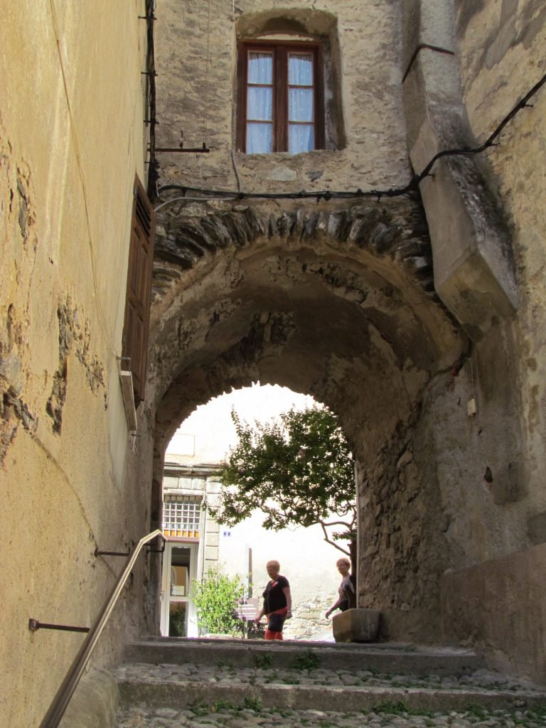
The sleepy village of Piana is at the top of the track. I found its pretty lanes to be quiet in the afternoon sun. The main road that passes through it is one of the most dramatic to drive along in Corsica. It allows tourists to visit the surrounding ‘calanques’ which are rock formations weathered into weird and wonderful shapes.


My Fishy Friends
Heading back down the same way I’d come up wasn’t half as strenuous as the journey up, but a refreshing swim still beckoned to wash off the dust. I was not alone in the water….. hundreds of fish were following me. I’d swim along, then look behind me to see an entourage of them trailing in my wake. I’m sure some of them were trying to look nonchalant and not like stalkers.

The rock formations provided plenty of opportunities for my overactive imagination to create objects and faces.

We spent the evening as the only boat in the anchorage and enjoyed a beautiful sunset with our open view to the west. And to the east? The peaks of Corsica provided a stunning backdrop and reminded us how lucky we are to live this life with its ever-changing view from our windows.

Calanques de Piana
As well as the rock formations on land, there is plenty to explore along the sea edge. We moved on again the next morning, but it being a short trip, we had time to stop for a look. We chose a bay towards the end of the peninsula where a couple of other boats had also stopped. The holding was iffy amongst rocky boulders but as there was no wind we took a chance on not reversing back too strongly to set the anchor and so reduce the risk of it becoming jammed.
Then it was time for a dinghy adventure! Caves to explore, tunnels to traverse, and rock formations to admire.
When we returned from our dinghy adventure, another yacht was having trouble retrieving their anchor and had to send someone in to dive down to try and free it. With our hearts in our mouths, we began to wind in Emerald’s chain. It was a huge relief when Colin called out that he could see the anchor hanging freely.
Cargese
As we headed south, the scenery became softer and greener, still attractive but less rust-red craggy. Our next stop was Cargese where there is a small harbour, situated well in behind a headland and well sheltered to sit out a westerly blow. We tried to anchor in the harbour entrance but found the bottom to be rocky and not good holding. Instead, we continued a few hundred meters to the east off a beach where there were acres of sand and good depths.
It wasn’t too far to dinghy back to the harbour, from where we walked up the winding road to the village. We detoured off to walk around the headland and the ruined tower there.


Exploring Cargese
The village is noted for its two Catholic churches that face each other. One was built by descendants of the Greek immigrants who first established the village in the 18th century. These Greeks had come from the Mani peninsula in the Peloponnese, where we cruised two years ago. It’s the little connections like these that we come across on our travels that remind me that in many aspects the world is a small place.
The second church was built by native Corsicans who followed Latin scripture rather than Greek. Until recently, the same priest conducted services in both churches, alternating between the churches each Sunday!
At the top of the village, a bar was perfectly placed to admire the views out north and west, it would have been rude not to have had a drink or two whilst we enjoyed them.


Ajaccio
It seems this coast is either too much wind or not enough, so another motor took us south to the largest town on this coastline. But mustn’t grumble given the alternative….. especially as we had to pass through the Iles Sanguinaires (The Blood Islands). They’re named for their colour, rather than a habit of drawing blood from anyone who ventures too close, but with their jagged outlook and surrounding shallow depths, not somewhere to get too near in a blow. All went well and no blood was lost from Emerald’s crew.
A westerly breeze picked up and chased us into Ajaccio. The anchorage shelves steeply so we had to get in close to get depths below 10m. It was a little cosy and we were on a lee shore with that westerly, but we felt well held in the sand.

Across the road from the anchorage is a large supermarket, perfect for stocking up on some more French specialties before heading to Sardinia. The town itself is around twenty minutes’ walk away, following the coast past a marina. It was the birthplace of Napoleon, so our third encounter with where he had once trod. There is a museum but we didn’t get time to visit.
The town is pleasant for a wander around, with a pedestrianised tourist street and plenty of bars and cafes to choose from.


Train Trip to Corte
Our main reason for visiting Ajaccio was to take the narrow-gauge railway up into the mountains. It runs several times a day from Ajaccio to Corte and beyond to Bastia and Calvi. The carriages are built with big windows for making the most of the mountainous views.
We took the early train leaving around 8 am and were surprised to find the platform crowded. Somehow, however, everyone got a seat. The train line hugs the coast around the bay before heading inland, climbing higher and higher, the scenery becoming more and more stunning.


Corte is Corsica’s wild heart. It was a historical setting for rebellion and resistance and for a short time in the 18th century, the island’s capital. However, the presence of hundreds of shuffling tourists (us included) in the sunshine somewhat diluted any perception of revolution in the air, but the citadel perched on its rocky crag surrounded by bleak mountains can go someway to displaying a feeling of defiance.
We visited the museum and citadel, taking in the 360-degree views of the surrounding mountains. There are lots of walks in the area and I declared Corte as a place I’d like to revisit by land when we don’t have to worry about where we’ve left Emerald.



Oh No, The Gas Boat is Coming
The next day we busied ourselves with filling up with diesel from a nearby roadside station and packing in a few more French food goodies. We’d planned an afternoon walk to Ajaccio, but the pilot boat came along and told us we’d have to move as a gas boat was due to visit. Right next to the anchorage is a gas port and when the ship is in, an exclusion zone is put in place. We could have stayed but it would have meant a pre 6 am departure the next morning.
Navily indicated there were some anchorages across the bay in amongst the rocky outcrops. We tried the first one of Chaviu but it was rocky and the swim buoys were set so that we had to anchor in deeper water. We had a go but when we checked the anchor, it was sat upside down between two rocks.
So we moved on to the next bay and found a spot behind the mooring buoys at Portogliolo. It turned out to be a peaceful spot until a plane comes into land at Ajaccio – it’s right under the flight path.

Tizzano
Our last stop in Corsica was at the port of Tizzano. The pontoons are only for small boats, so we anchored to the north of the buoyed entrance channel in a big patch of sand. The north side turned out to be the favoured spot as it provides protection from the swell from the west. It was our busiest spot on this coastline with several large charter boats trying to squeeze in around us.

Tizzano has a beautiful beach a few minutes walk away to the south and to the north, a coastal walk heads out for several miles to a lighthouse. It passes some very pretty, sandy coves which we were sure would be wonderful to anchor in settled weather. We were back in the land of crazily carved sandstone, the fingers of the wind and rain weather artists creating sculptures more bizarre than any modern art.


Below Emerald, our fishy entourage continued to swim and we watched as a large barracuda joined in for a few laps of the hull. Above decks, Tizzano was the land of the flying ant. Emerald was covered in them – once they arrived they promptly died leaving a mass of black ant carcasses to clean off the windows and deck.
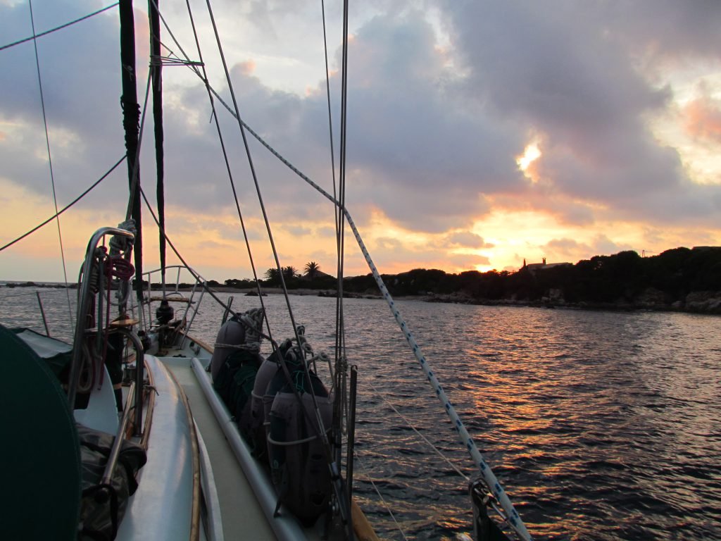
Early the next morning we headed off for Sardinia.
Sailing Info
5th Sept: La Revellata to Cala Tauro, 26nm 7nm sailed
Anchored 8m in sand 42 20.337’N 8 37.561’E
Ashore is a large beach with resident cows!
A 5-minute dinghy ride around to Girolata where basic provisions are available. There is also a marked walk to the village.
8th Sept: Cala Tauro to Ficaroja 7nm
Anchored in sand 10m 42 15.156’N 8 37.597’E
Swimming buoys limit the anchoring area but it is still possible to squeeze 4 or 5 boats in. Trip boats visit during the day but didn’t stay very long.
9th Sept: Ficaroja to Cargese 14nm
Anchored 6m in sand 42 07.969’N 8 36.705’E
There is a harbour at Cargese but we chose to anchor off a sandy beach to the east of the town.
Walk up the hill to the village where there is a supermarket, bars, and restaurants.
10th Sept: Cargese to Ajaccio 32nm
Anchored 8m 41 55.955’N 8 45.039’E
We anchored at the head of the bay, next to the moorings by the marina. There is a gas depot there too and if the gas boat comes in, anchored boats are moved on. Unfortunately, it chose to visit on our last day there. Alternative anchorages are available close by.
A large supermarket and petrol station are close by the anchorage; a quay has rings in it for tying up the dinghy.
12th Sept: Ajaccio to Portogliolo 10nm
Anchored 8m 41 47.984’N 8 43.508’E
We anchored behind the moorings, just an overnight stay, and didn’t go ashore.
13th Sept to Tizzano 22nm
Anchored 6m 41 32.485’N 8 50.913’E
The harbour is off-limits to larger yachts but can be used for tying up the dinghy. A small grocery store as well as a couple of restaurants.
The Social Media Bit: Want to Follow Us?
If you’d like to follow us on other social media platforms (Facebook, Instagram and YouTube), you can do so by using these links:
Or use the link below to track our voyage on NoForeignLand.com.
And finally, you can sign up to receive email notifications of new blogs using the subscribe box at the bottom of this page.
Thank you from Nichola & Colin


Enjoyed reading this, loved your photos
Fantastic photos !
So much to read !
I will take time for it .
Thank you very much !
Mallorca next time ?
Fair winds for a nice winter
And Felices Fiestas !
Chantal Huron
Felices Fiestas Chantal! Yes, we will be heading your way late summer We packed in a lot in a short time in Corsica, it’s taken me until now to finish writing the blog thank you for your lovely comment